


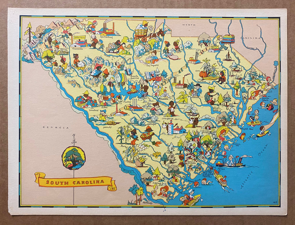


1935 South Carolina Pictorial Cartoon Map by Ruth Taylor
Calculate Shipping
Date: 1935
Artist: Unknown
Size (in): 12.5” x 9.25”
Size (cm): 31.8 x 23.5
Condition: B
Linen backed: No
This is a vintage original cartoon pictorial map of South Carolina created by Ruth Taylor from the atlas published by Taylor and her husband Frank in 1935 titled Our U.S.A. – A Gay Geography. This map is elaborately illustrated with many caricatures and colorful icons highlighting points of interest around the state. Taylor’s initials “R.T.” appear in the lower right hand corner of the map.
This map is a vintage original issued in the Taylors' 1935 atlas of pictorial maps. This map has a pen mark that runs along the Savannah River to the lower margin and is otherwise in very good condition overall and very suitable for framing or display. Please see our other listings for more Ruth Taylor pictorial state maps from this series.