


1949 Gaspe Peninsula Canada Vacation Pictorial Cartoon Map Stanley Turner Brading Capital Brewery
Regular price
SOLD
Shipping calculated at checkout.
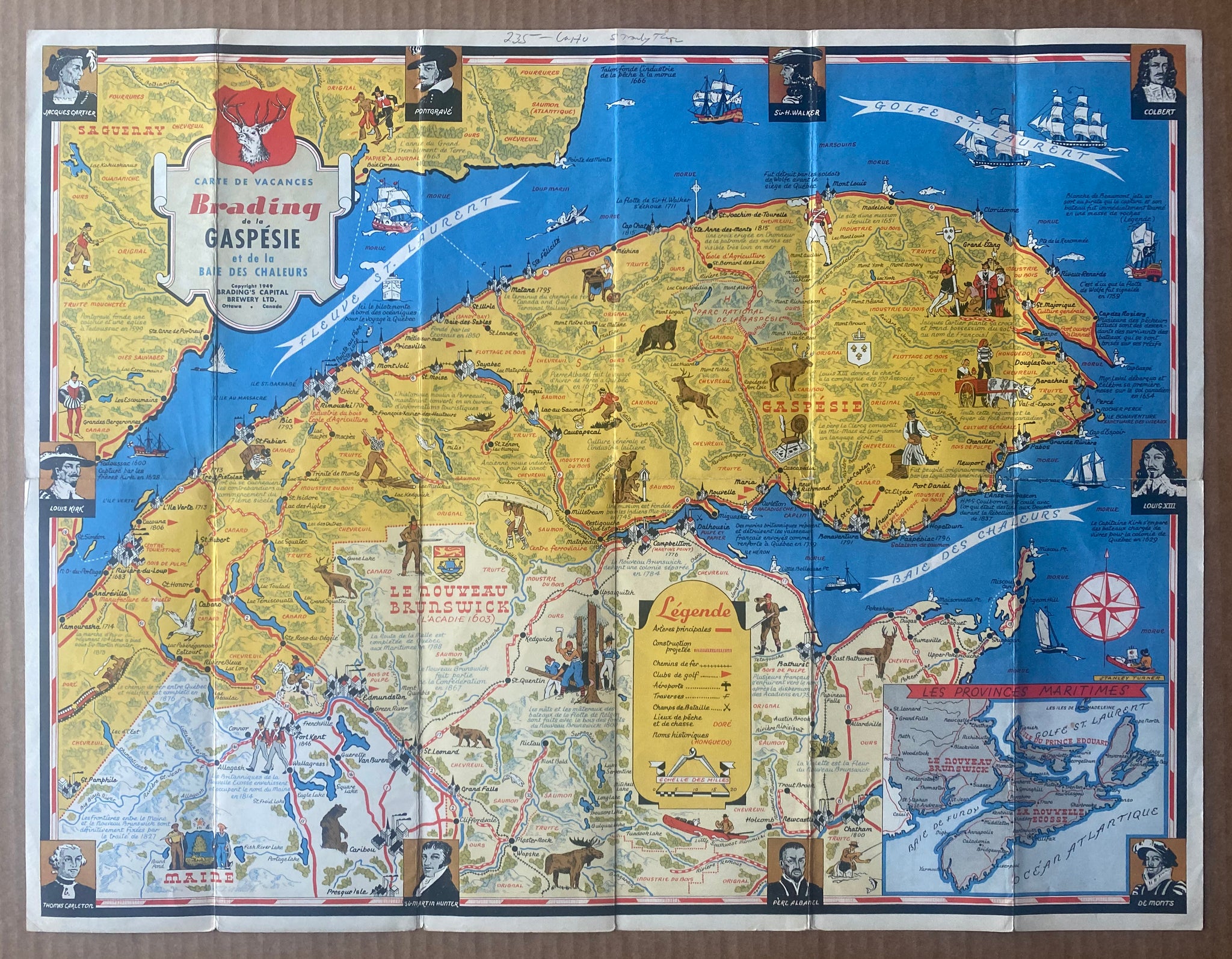
This is a vintage original 1949 folding pictorial cartoon vacation map of the Gaspé Peninsula and Chaleur Bay region of Canada created by noted pictorial mapmaker Stanley Turner and issued as an advertising piece by the Brading’s Capital Brewing Ltd Company of Ottawa, Canada. This map is a single piece that folds open to about 23” x 17.5” with the elaborate pictorial cartoon map covering the entirety of one side. This map has French language text and the front cover panel is titled:
Carte de Cacanes Brading de la Gaspésie et de la Baie Des Chaleurs
Both the front cover panel and the map itself have 1949 copyrights so thus the date. Stanley Turner’s name appears printed in the lower right had corner of the map. The verso has the cover panels, tables of distances and some advertising for Brading Breweries Limited. This vintage original map is fully complete and intact with some toning from age and moderate handling wear. Overall condition is very good.